
Apr 24, 2024
Apr 24, 2024
The Indian Ocean Tsunami of 26 December, 2004 will go a long way in to the history. As I often repeat, human memory is volatile. We have very few records, verbal or written of the past disasters. Yes after the advent of modern science some system was developed. The limitation was the event itself. Since a tsunami had not adversely affected the coastal population in India in the recent human memory, there was no mention of them in the records. Now after the tsunami disaster the scientific community is rummaging through the pages of past records to find out if similar or worst events took place in the past as well! An accidental discovery off the coast of Gulf of Cambay in Gujarat in 2000 was widely publicized by the media. At that time the 'tsunami angle' was not foreseen. The find of buried township in the ocean bed was quite remarkable. While carrying out routine pollution monitoring, the scientists of the National Institute of Ocean Technology (NIOT) in the Gulf of Cambay in 2000 found something unbelievable. There were marks of a civilization on the sea bottom at a depth of 40 metre. 'The sea at the Gulf of Cambay is peculiar', says Dr. Badrinarayanan, a consultant scientist with the NIOT, Chennai. It has fast changing tidal currents that brings enormous silt from the bottom and makes the seawater opaque and videography undersea becomes impossible. Therefore, sonography is the only recourse left to study undersea pollution and other features. The side-scan Sonars installed in the ship of NIOT picked up several geometric patterns, something unusual for the marine domain! These turned out to be remnants of not one but two pre-historic habitations. Dredgers were used for collecting samples and hordes of artifacts, potsherds, hearth pieces, animal bones, human teeth and a carbonized wooden log were collected. Gujarat has been a province of upheavals since the geologic past. The NIOT team located a fault in the paleo-river channel in the sea bed that had displaced the sediments by 30 metres. Such faults are due to neotectonic activity. Neotectonism, sea level rise or even a deluge by a powerful tsunami could have buried these habitations under the sea. Taking a cue from the past it is high time for the government and the society to take steps to safe guard the present habitations along the coasts. The earlier civilizations were lost to marine disasters but the present should not be permitted to vanish like them. 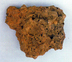 Records of coastal townships in Gujarat, also along Tamilnadu coast being buried in the sea are many. Dwarika, supposedly the capital of Lord Krishna also lies buried in coast of Gujarat.
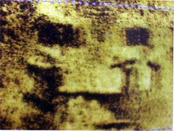 The sea bottom sediments pointed to the presence of two East--West running sub-parallel, paleo-river courses in the sea bed. The evidences of habitation were found along both. Dating of artifacts and other objects showed that southern river valley was 13,000 to 8,000 years old and the northern valley was 7,600 to 3000 years old. In both the cases the sizes of the houses on the western side were approximately 16x15m and 3x4m on eastern side. It appeared a rich and poor divide had already developed in that pre-historic society! Probably rich lived on the west and the poor on the east! The sonar images indicated the presence of apart from dwellings, a giant water storage tank that was 700x800m and 5-6m deep. In addition plastered drains and grain storage bins were also located. All these point towards a well developed, prosperous township. Alas the habitation now lies buried in the abyss of the sea!
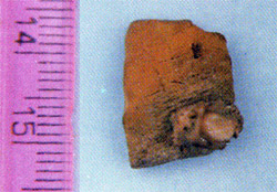 Similarly from the satellite imageries two years ago NASA reported two to three presumably man made bunds in the sea in the offshore area between Cape Comorin and Sri Lanka. Incidentally this is the same spot where the epic Ramayan mentions about the stone bridge made by Sri Rama. In Tamil folklore also this area is known asKumerikandam, a centre of literature and arts more than 7000 years before present. The scientists of NIOT suspect that about 10,000 years ago this area was a land on which the bunds were made as water storing structures. In other words this was another area which was engulfed by the sea and again possibly due to a tsunami or a drastic sea level rise!
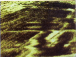 Coastal habitations are prone to disasters since times immemorial. The affluent habitations of the past along the coasts were either engulfed by the sea or left dry by the withdrawing sea. It is significant to know how these civilizations vanished!
The sediments of the sea bottom in the Gulf of Cambay tell an interesting story. The older (60 to 10 million years) sediments are of marine origin with marine fossils. Gradually the sea withdrew and the presence of fossilized roots of land plants in the sediments that are one million year old show that land was exposed. Rivers started to flow through the Gulf of Cambay. The settlements came up along the ancient rivers.
13-Jan-2007
More by : V. K. Joshi (Bijji)