
Apr 20, 2024
Apr 20, 2024
 Human civilizations and rivers have been part and parcel of the same eco-system. Water means life and naturally all living beings including humans get attracted towards water bodies. Since times immemorial major civilizations have developed and vanished on river banks only. They prospered on the river banks because of availability of water for drinking and irrigation and vanished because of mega floods. We read about Mega Floods of the Past in the previous issue of boloji.com. Today some of the mega floods are known because of the strides made by the science of floods or the science of river behavior, whereas in the earlier eras of human history-floods were taken as a curse of God.
With the passage of time, the river dynamics were known, how they flood was known, but at present there is a dire need to know the river around which human habitats are located. The floods do not distinguish between developed and developing nations. A river in spate just maroons everything.
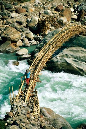
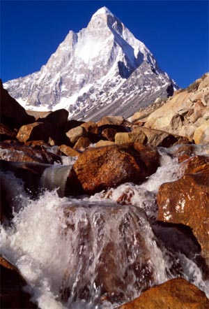
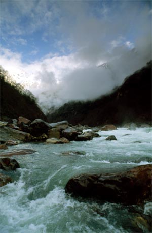
Marsygandi River Shivling mountain
above the Gangoti glacier
Vishwas S. Kale, a geographer of repute and an active researcher on floods has elaborated the need for Research on floods in India in one of his papers published in Current Science. In India flooding is the only natural hazard that occurs with unfailing regularity, says Kale. Some of the major floods have occurred in the recent years, amongst which the flood in Godavari River in 1986 with a peak discharge of 99,300 meter cube per second is the largest flood on record in the entire Indian sub-continent till date, claims Kale.
The flood prone areas have been mapped by different government agencies. Their studies have indicated that Sub-Himalayan regions and Ganga Plains, Brahmaputra Valley, Punjab Plains, Mahanadi, Godavari, Krishna-Kaveri Delta Plains and Lower Narmada-Tapi-Mahi Valleys are most prone to floods.
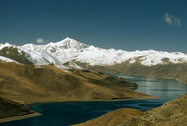
Yamdrok Lake
Floods have been part and parcel of the environment since ages, through which science has developed and lot of data has been collected about the mechanics of floods and capacities of different rivers to flood, it is time that the data is converted to information. There is an acute need for information on the physical, hydrological, geo-morphological and meteorological aspects of monsoon floods, says Kale. The information is available but widely scattered because a variety of organizations are involved in studying the flood patterns of the Indian rivers. Kale attempted to collect and collate the data and tried an analysis to interpret the river behavior.
 As per Kale’s research the annual peak discharge data of upper Ganga, Krishna and Brahmaputra Rivers show a decreasing trend in their peak discharges. On the other hand, Narmada, Godavari and Satluj Rivers show increasing trends. Similarly, Beas River peak discharge shows a decreasing trend while the annual peak discharge of Chenab River shows an increasing trend.
The research has shown an interesting trend. Though the area affected by floods has neither increased nor decreased of late, but the population affected by the floods in the same period has significantly increased. This is alarming because it indicates more development and growth along the flood prone areas. It is well known fact that the flood pathways should be left clear for the river to offload its extra load. However, turning a blind eye to this fact concentrated habitats have come up not only on the flood pathways but also on the river banks. This has been a mistake on part of the governments and society which made a larger chunk of population vulnerable to floods.
In order to confirm the pattern of large floods that can really affect such habitats quoting D.V.B. Rao and his companions, Kale says that a study of more than 100 year’s data on cyclonic frequencies over north Indian Ocean for the period 1877-1998 shows an increasing trend during the period 1880-1930 and 1950-1970 and decreasing trends during 1930-1950 and 1950-1998. Another study dealing with heavy rainfall events during the period 1901 and 1990 indicates decreasing trends over most part of the country. These reports therefore no where suggest that the rainfall events leading to extreme floods in the country increased over the century to affect a larger chunk of population.
 Studies on the annual peak discharges of some of the rivers in India have shown that inter-annual variability in peak discharges was lower during the first four decades of 20th Century, followed and preceded by several decades of high inter-annual variability. This trend is broadly consistent with the long term variability in the all-India monsoon rainfall index, says Kale. Studies also show that mountain fed rivers like Ganga and Gandak show a high variability in inter-annual flood discharges.
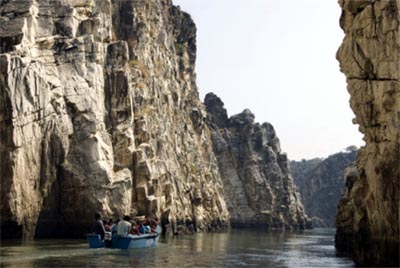
(Image shows Narmada River passing through Jabalpur mountain terrain)
Geomorphic processes such as avulsion, channel migration and rise in the channel bed due to aggradation is are common in the rivers of Indus-Ganga and Brahmaputra plains. One of the recent examples is the avulsion of Kosi River in 2008 and a sudden hops scotch by going back to a 200 year old course (read Revenge of Kosi). Such sudden changes by a river are disastrous, because of the densely populated valleys of the said rivers in the plains.
It has been a practice for past several decades to erect bunds on the banks of the rivers to protect the habitation. To begin with these bunds show positive results and save large areas from inundation. However, over a period of time the river starts offloading its excess load in the channel itself and goes ahead. The process raises the river bed and ultimately the height of the bund has to be raised and at times the river breaks the barrier during its peak flood and cause massive damage. A study by Kale and his colleague shows that total amount energy generated during the monsoon season is in the range of 37 mega joules in deficit monsoon years to 256 mega joules during excess monsoon or flood years. It is anybody’s guess that a river packed with so much energy during peak flood can not be restrained by a bund.
It is an irony that the planet earth is passing through a warming phase, which started some 18000 years ago after the last expansion of the Polar Ice. In such a phase we must be prepared to face severe droughts and floods say the scientists. The concentration of habitats close to rivers complicates the issue. Of late it has also been realized that the structural measures like dams, bunds etc though yield quick results are more harmful in the long run for the river flow. Therefore use of state of art technologies of Remote Sensing and Geographical Information System (GIS) are the need of the hour for flood management. With their help flood forecasting, flood inundation mapping and flood plain zoning becomes more precise and faster. Delineating flood hazard with the help of GIS incorporating meteorological, geomorphical, topographical, land use and demographical data saves many a lives and properties because almost real time flood forecasting is possible.
Real time flood forecasting has gained importance especially in flood prone countries like Philippines. Scientists of the College of Science of University of Philippines have developed a ‘contraption’ that sends flood warnings via cell phone-like device, says ABS-CBN News. Several sensors are placed along the course of a river and data collected by them is collated and in case of an anticipated flood warnings are issued via short text messages. In case an advance warning is available at least several lives can be saved by moving people to safer areas.
The habitats that have been allowed on the river banks can not be shifted, but at least the governments can take stricter measures to check further growth of such habitats and also stop permitting construction of residential blocks on the flood prone areas in the cities. In the field of telecommunication, fortunately India has developed very well. The cheap and effective system developed by the scientists of the University of Philippines can be further improved and used for our rivers as well and convey timely warnings to even village population.
01-Nov-2009
More by : V. K. Joshi (Bijji)